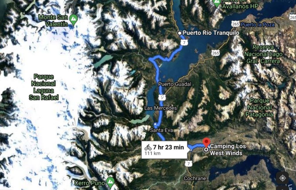
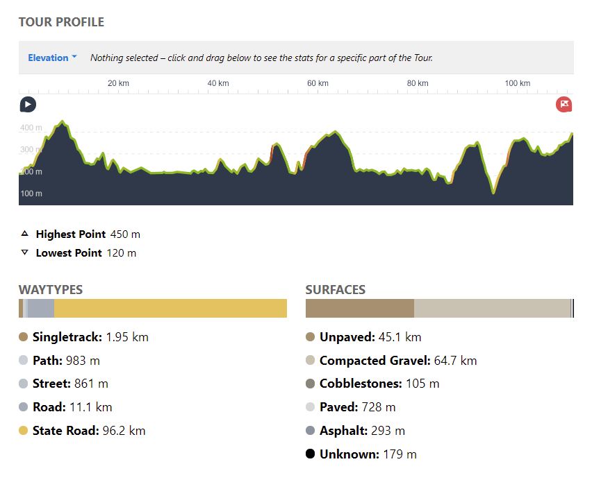
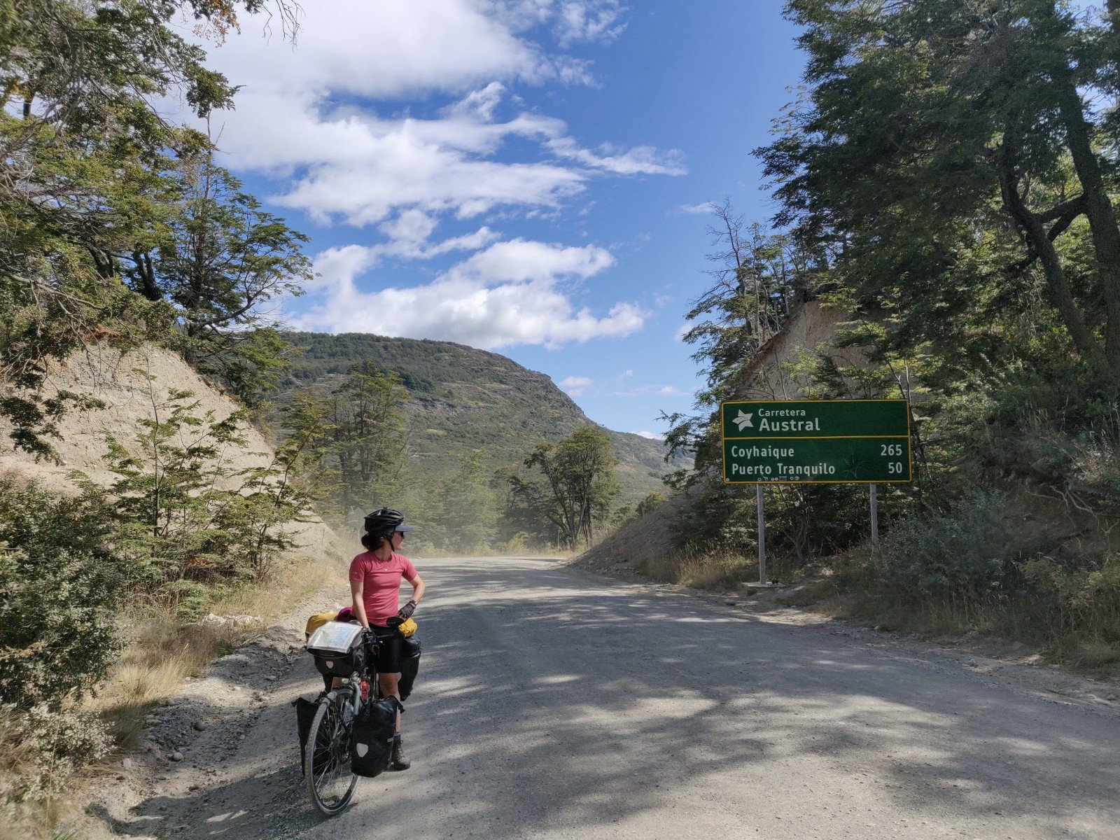
From Puerto Río Tranquilo to Parque Nacional Patagonia 111 km; uphill 1,690m; downhill 1,500 m
We awoke on Sunday with slightly sore heads, but well rested after our boating and feasting of the day before. Unfortunately we also hadn’t noticed the amount of dust being thrown up off the ripio road behind our tent, which had covered all Hannah’s washing in a fine layer of white. At least the clothes smelt much better.
Not having seen a checkout sign we packed up leisurely. At noon we finished loading up our bikes and were treated to the wrath of the owner, who demanded to know why we had not already left the deserted field by the 11am checkout time. After briefly attempting reason with him to no avail, we made a swift retreat to the other side of his fence and finished off packing, leaving him muttering and grumbling as he began cleaning the outdoor cooking area.
We walked our bikes the couple of blocks into the village and Hannah gathered groceries with Robbie bike-guarding outside. Then stopped for a lemonade on some outdoor decking before oaty lunch on the very windy beach. Pouring oats and hot water into a bowl in a sand storm was tricky, and lunch was a brief affair. By 2pm we were ready to depart and set off south on the Carretera towards Cochrane.
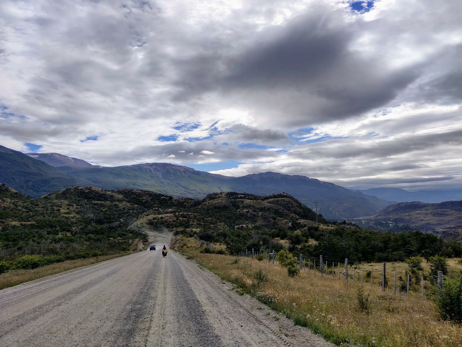
The ride began with a steep climb southeast up and over the marble cliff formations far below. Traffic was steady but much heavier than Exploradores and the ripio below average, making for a challenging afternoon. At last we began descending as the road turned southwest and away from Lago General Carrera. We passed a solo Belgian cycle tourer heading north who also bemoaned the state of the road, but encouraged us with his views that it was generally better south of Cochrane.
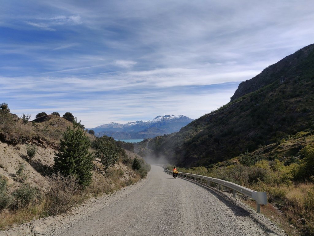
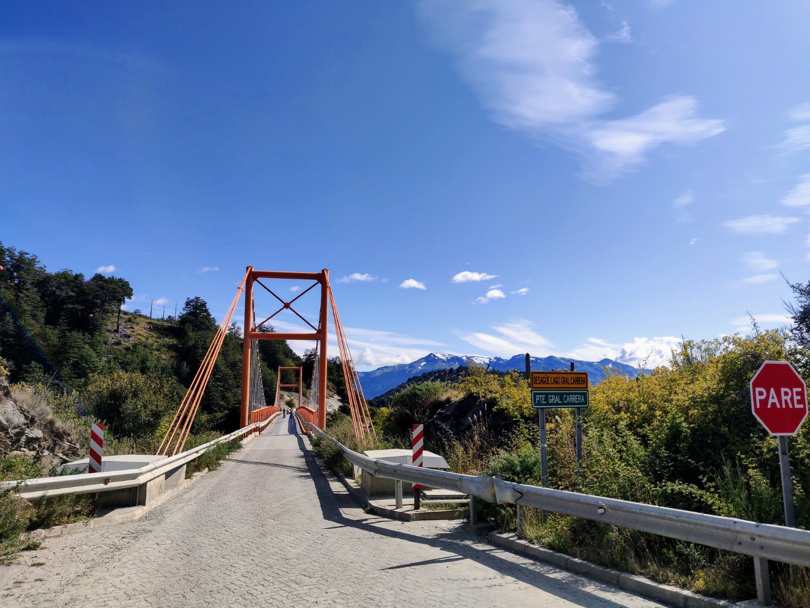
By mid afternoon we were back down at lake level, heading west and into a headwind which seemed to appear from nowhere. Whilst now on flat terrain the road was still awful and it was a battle to make progress the last few km up a river delta. Finally we reached the bridge crossing the river where the road turned abruptly southeast, and we turned off for a couple more km west to our planned campsite for the night.
We arrived at the camp to find locked gates, a distant dog barking and no sign of any owners or other campers. The site did not look particularly inviting and we decided to give up on it and head 8km east instead to a well-reviewed wild camp spot just off the Carretera. To our relief the road condition improved greatly on this south side of the delta and we flew along powered by our new tail wind. Soon the road turned south and in another km we arrived at the marked spot just by another river near the Punta Baja aerodrome.
We turned our bikes off the road and down a track to the river, and used iOverlander reviews to locate the preferred spot, a decent grassy area well sheltered by the wind. Just as we were about to start unpacking we heard a hola from the road and saw another solo cycle tourer, asking if we had found the spot. We beckoned him down and met a young Italian man, Lorenzo, also heading south, but from far further up the continent.
We pitched camp together, pleased with each other’s company so close to the road, and chatted whilst cooking dinner. It turned out Lorenzo was an architect by training but had grown tired of producing unsustainable developments for wealthy developers and now is looking to move career into sustainable education. We talked well into the dusk before bed.
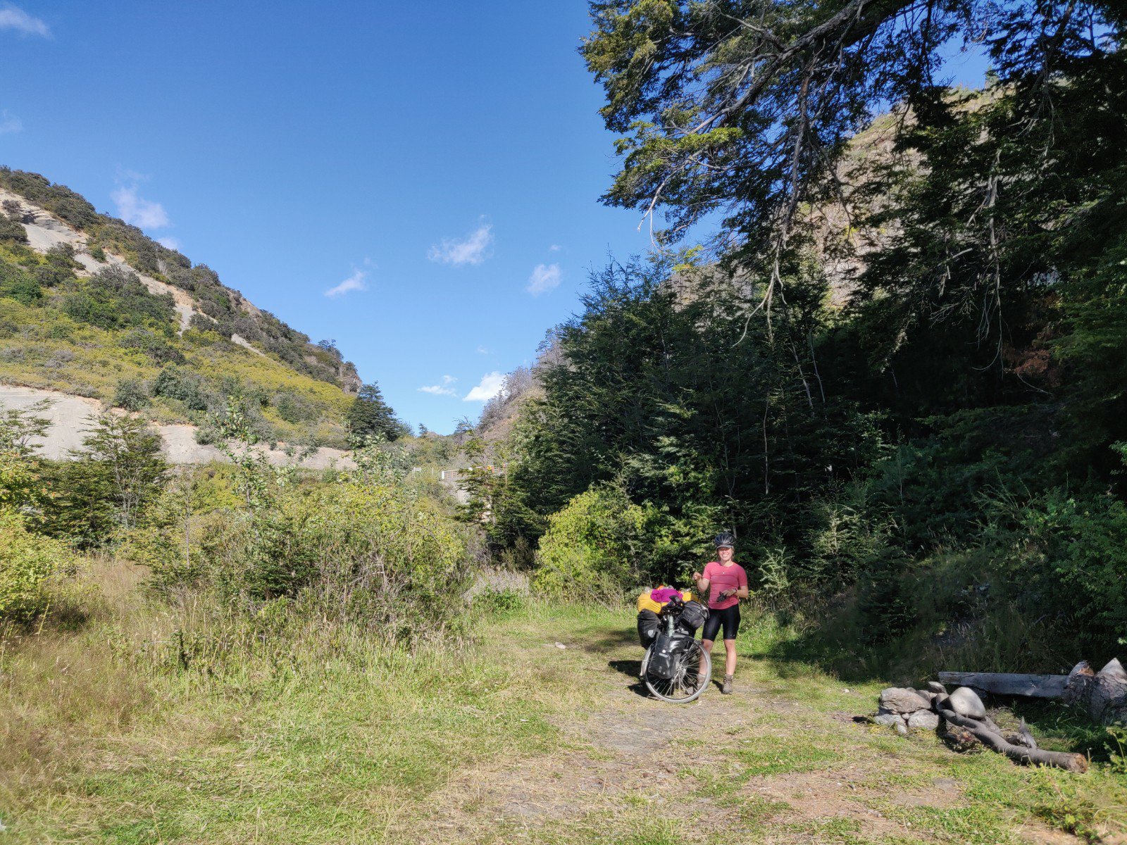
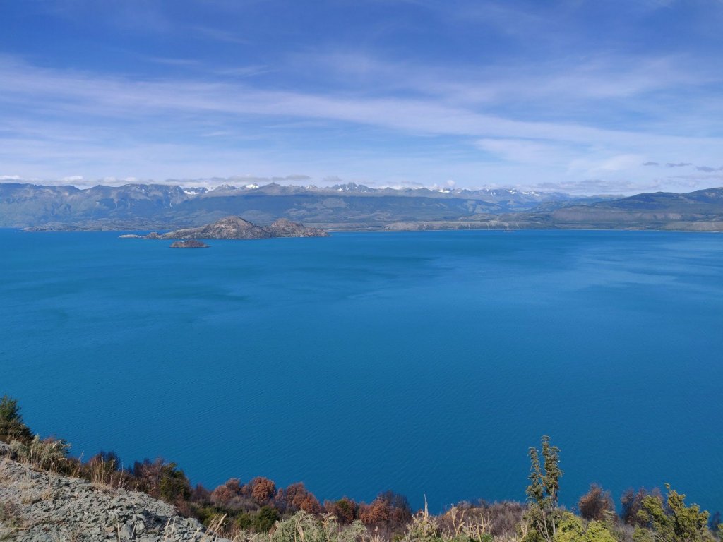
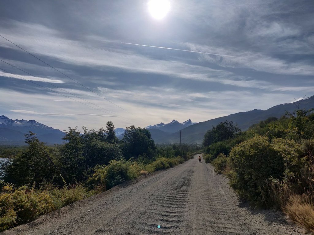
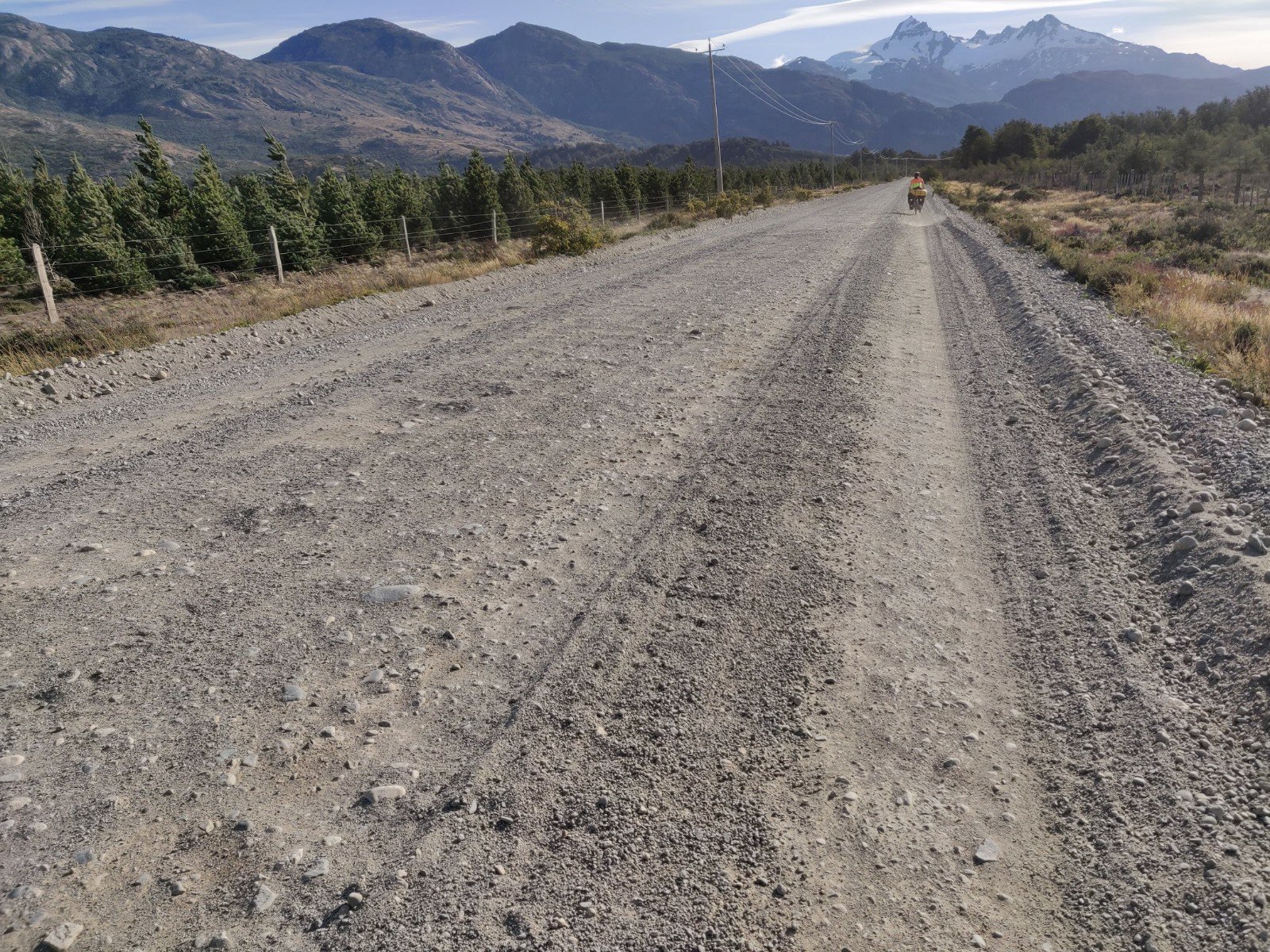
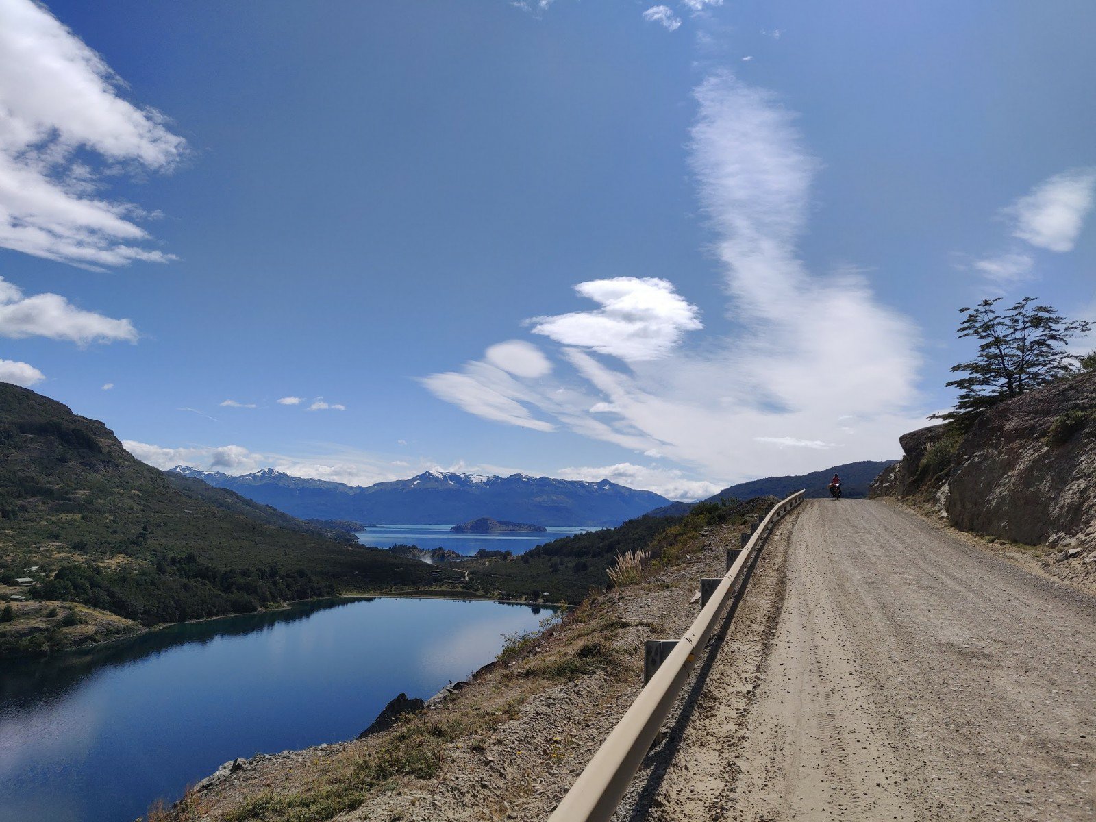
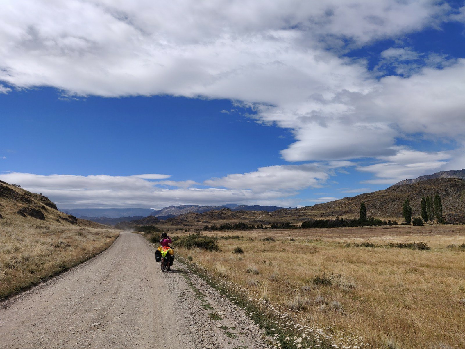
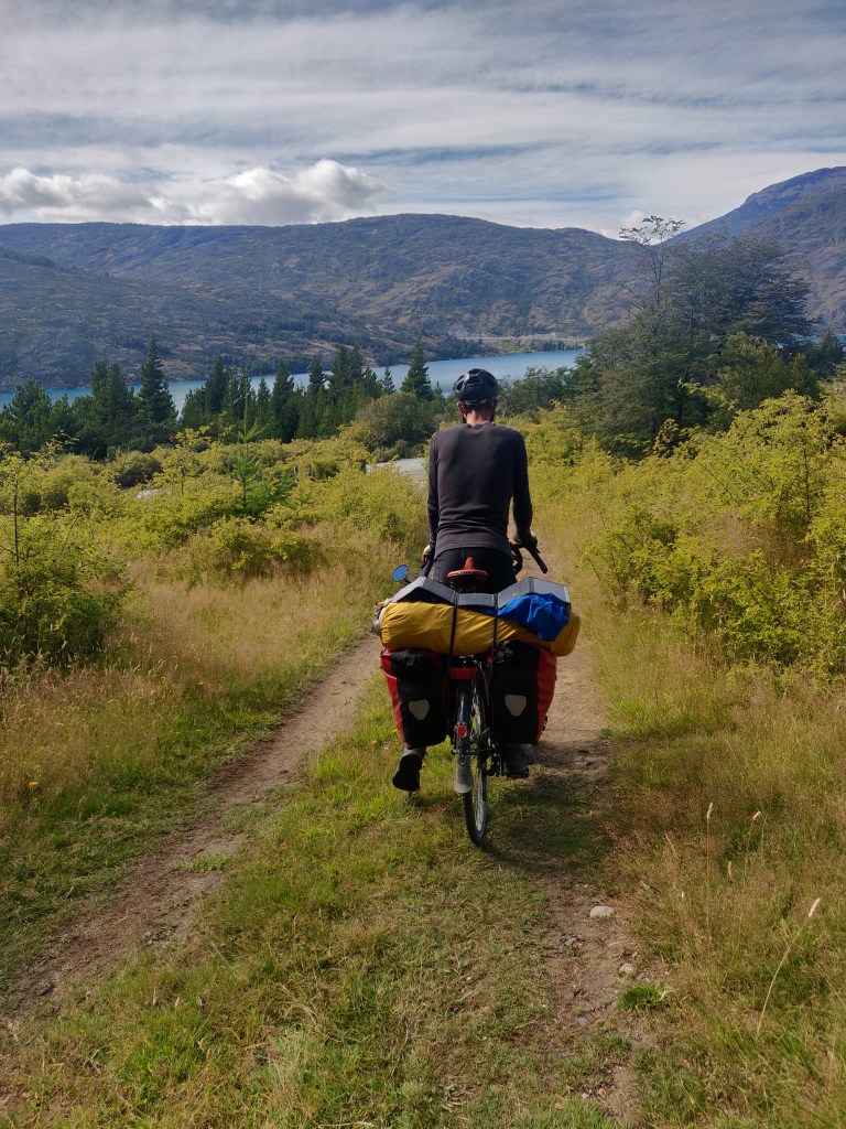
On Monday 24th February we packed up our little wild camp and waved Lorenzo farewell. He aimed to make it all the way to Patagonia national park today and camp inside. We were less optimistic and aimed to make it up the Rio Baker valley as close to the park as possible. Heading due south now we soon rejoined the southern-most corner of aquamarine lake general Carrera for the last time. The ripio deteriorated once more as we proceeded up and down hills along the shore and across the Lago Bertrand confluence bridge.

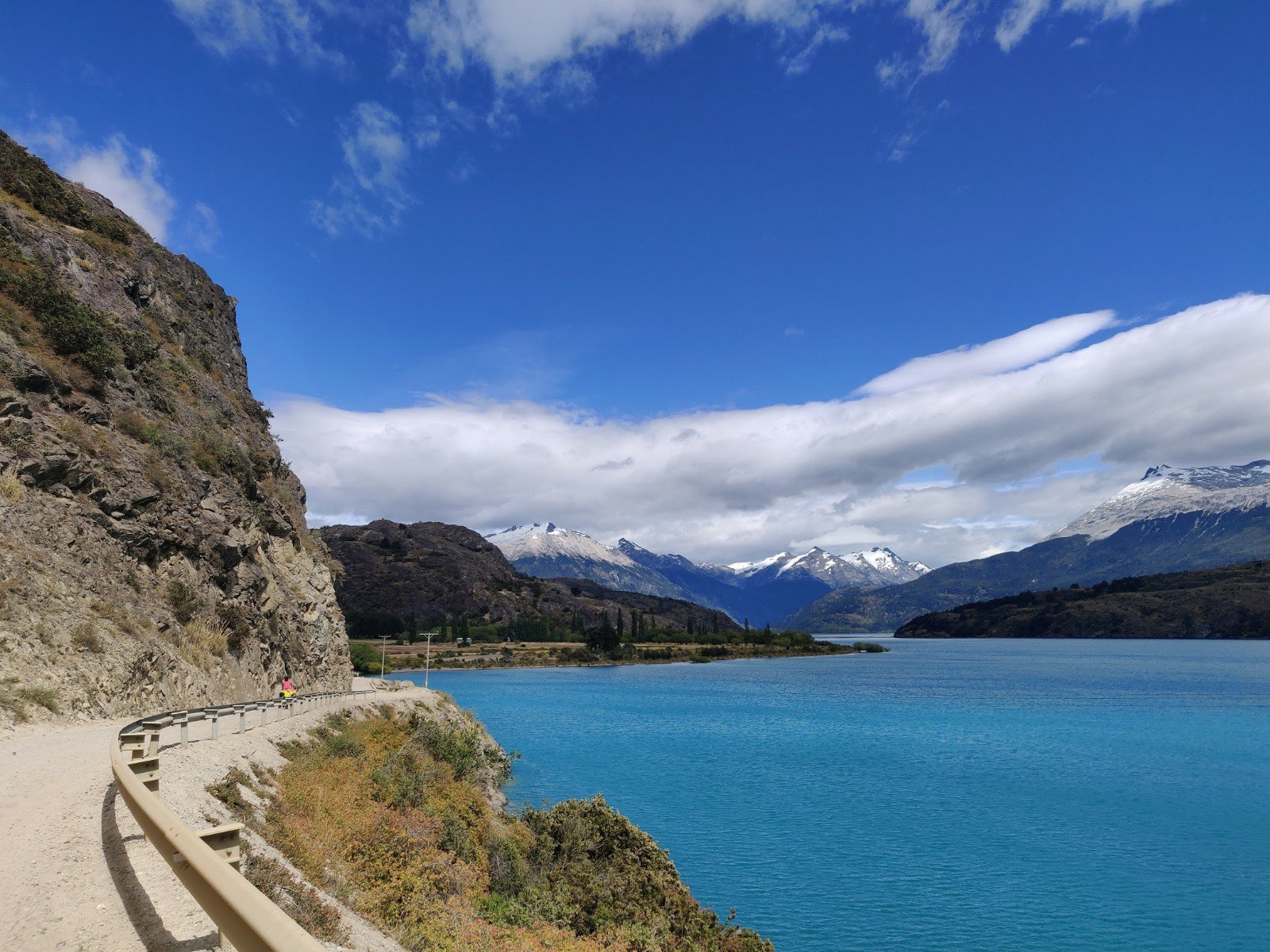
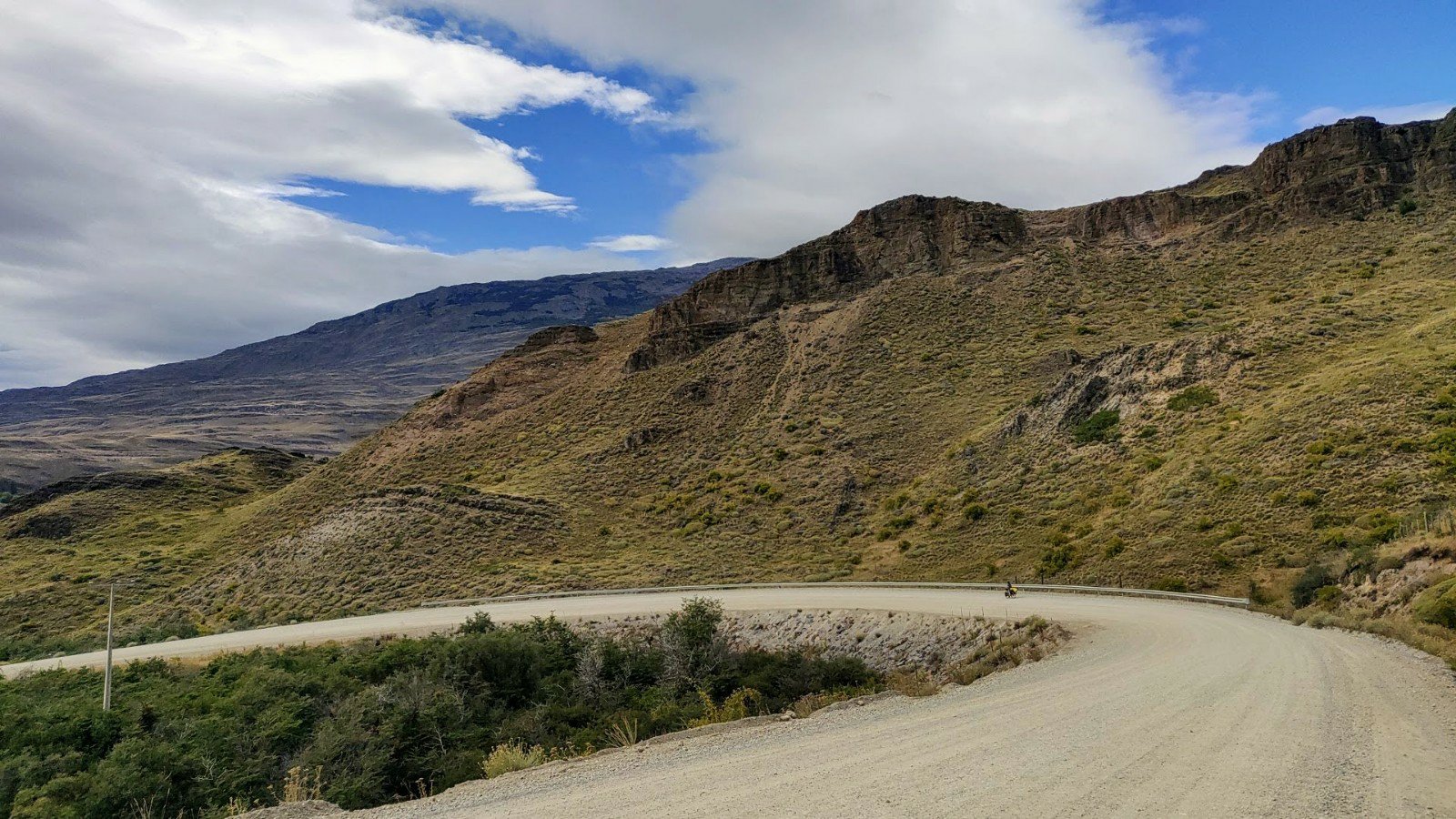
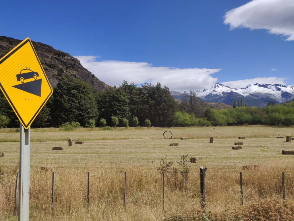
We reached the turn off for Chile Chico before long, where route 265 tracked east to one of the primary border crossings into Argentina. Sadly, better ripio on this route stopped abruptly as the Carretera turned southwest, and we were left cycling up very loose sand past Lago Negro to the west. The forest-clad slopes resulted in dark water giving the lake its name, and looking back we got an impressive view of an exclusive resort on the eastern shore. We descended again to a breezy inlet of Lago Bertrand, this a more conventional colour, tracked south along the shore and then began the biggest climb of the day, 200 metres up away from the lake, steeply at first but then more gradually on a higher plateau.
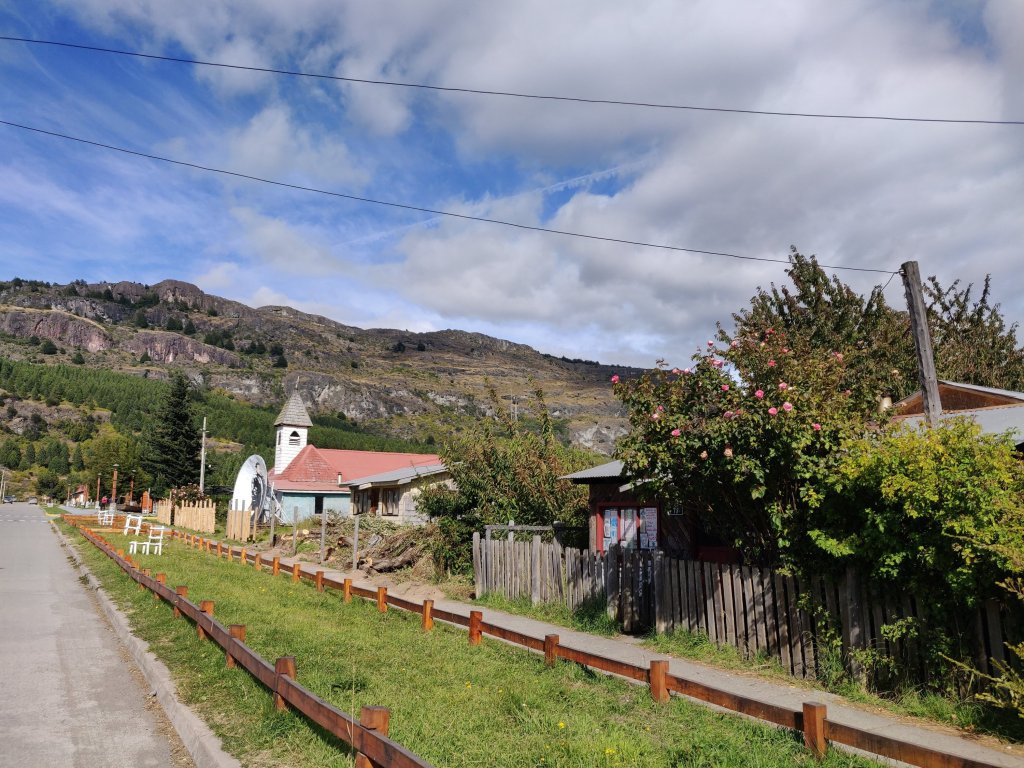
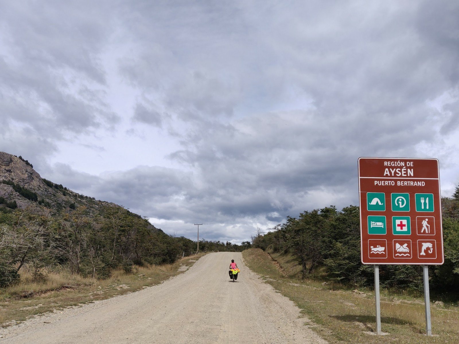
A few more km past some isolated farmsteads we descended whilst turning sharply to the northwest and wound down to the village of Puerto Bertrand. Spread along the steep valley side, with terraced streets, we started at the top where the most enormous sculpted village green was laid out with diagonal paths and central band stand. It was completely deserted but did provide a useful set of bins for depositing rubbish. We descended steeply from the back of the square to the shore of the Rio Baker, which flowed out of Lago Bertrand a few km to the north. This was the touristy heart of the village, with cafes, hostels and white water rafting tour offices. We found a bench by the wide river next to a pop up bus cafe, and ate our oats, sheltering from the gusty wind. Loud music from the bus and rubbish on the ground soon grew annoying and we swiftly moved on to find a more tranquil spot.
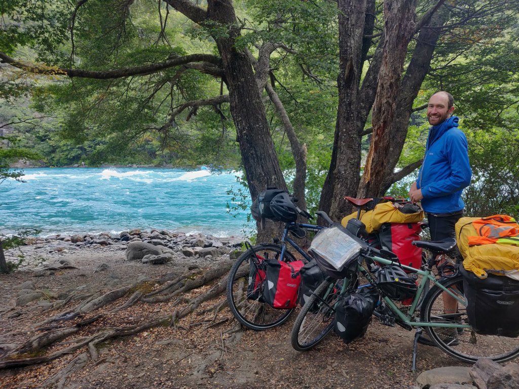
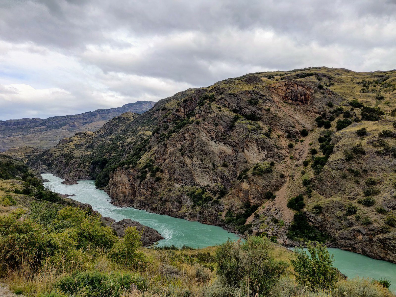
The Carretera continued south and downstream along the east bank of the mighty Rio Baker, which soon erupted into rapids. We heard these before seeing them, thick forest now separating us from the river, but after a mile a break in the trees revealed aquamarine river water churned white by the rapids. We walked down a short track to the bank for tea and cake, and watched rafters and kayaks passing by, a few friends and family filming nervously from the bank. One or two fishermen cast their lines into the water from the far bank. Well rested now, we resumed the ride southeast along the river, gently up and down as the river gradually sunk down below us. A young French couple appeared cycling north, having come from Argentina via the o’Higgins crossing and reassured us that it was perfectly doable on bicycles.
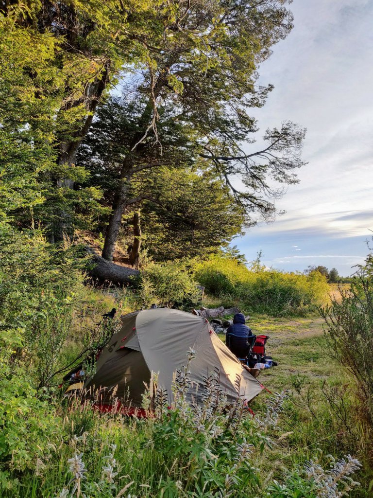
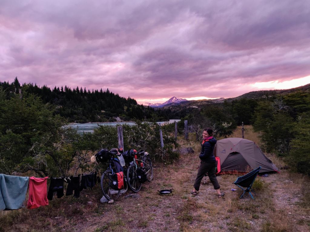
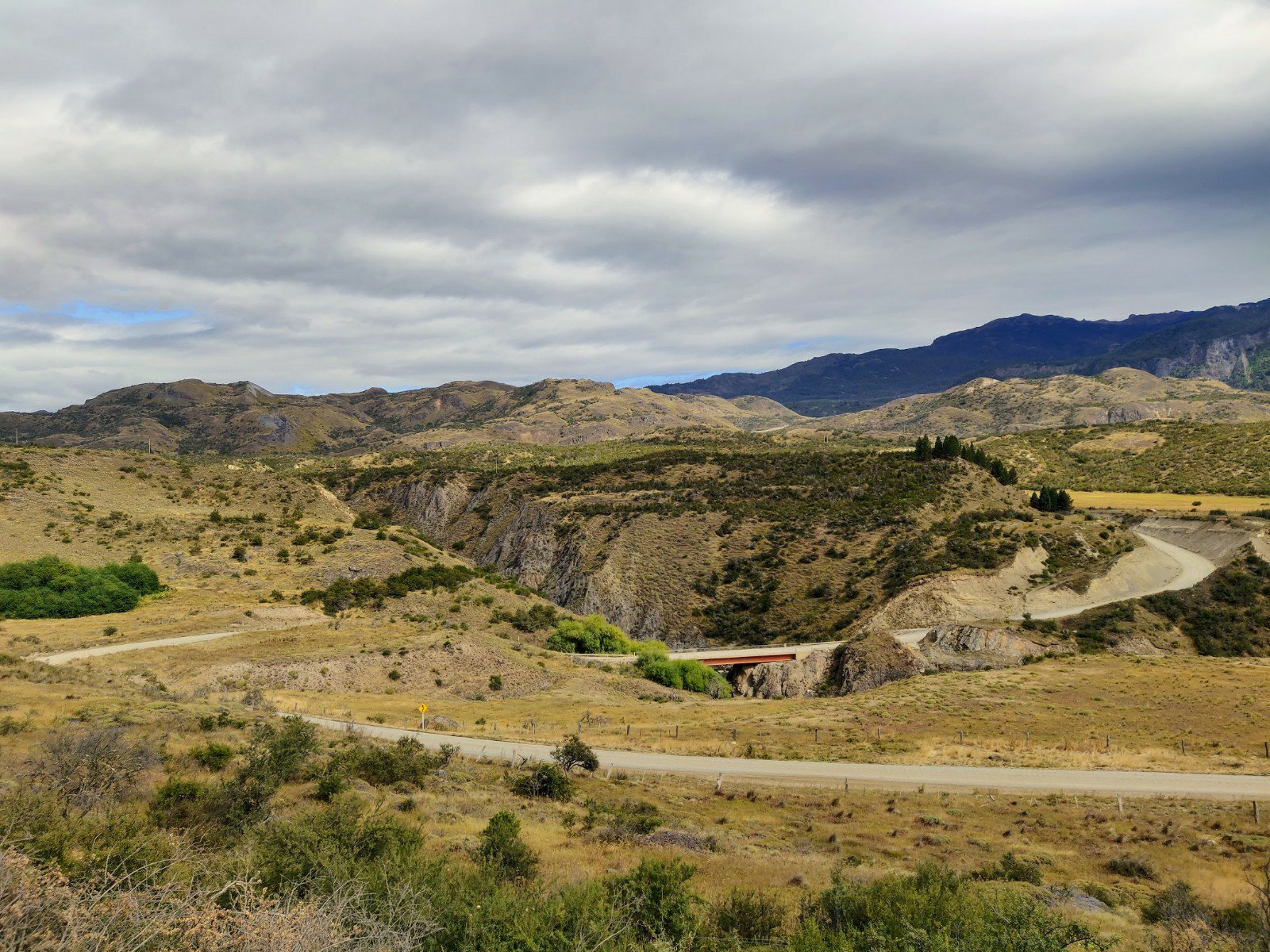
After an hour, the river meandered away from us briefly and then reappeared, now quite far below us. We started checking for wild camp spots and picked out a couple on a minor road near the river just off the Carretera. We descended quite steeply before the junction leading down to the sites. Hannah turned off the road first and immediately hit loose gravel sloping steeply to the right. Whilst moving at less than 5 mph, she had no control whatsoever and ended up toppling diagonally straight over the handlebars. Fortunately her cycle gloves took the brunt of the impact but one knee was grazed and a pannier bag clip had sheared off, lost in the gravel. A little shaken, but not too stirred, Hannah walked down the rest of the slope as Robbie tried to find the camp spot.
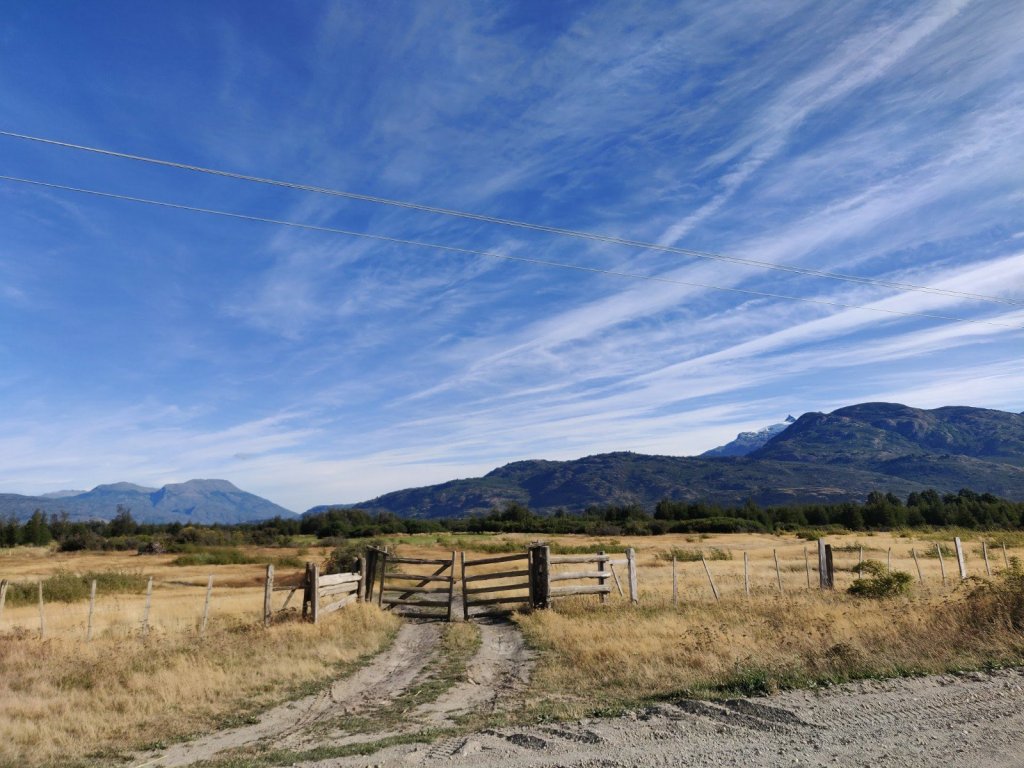
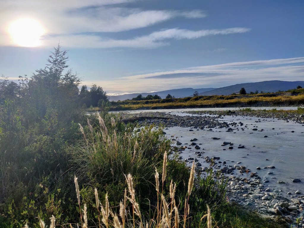
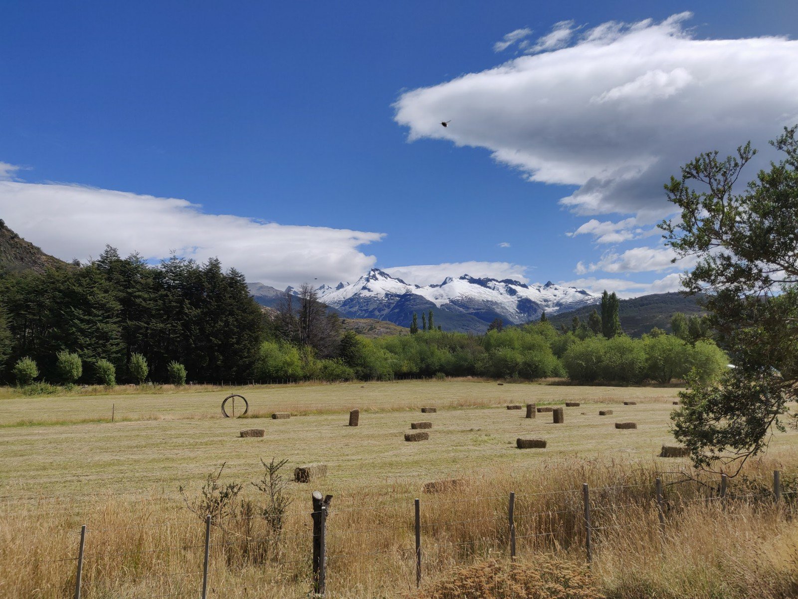
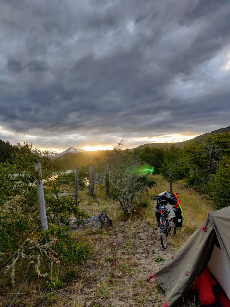
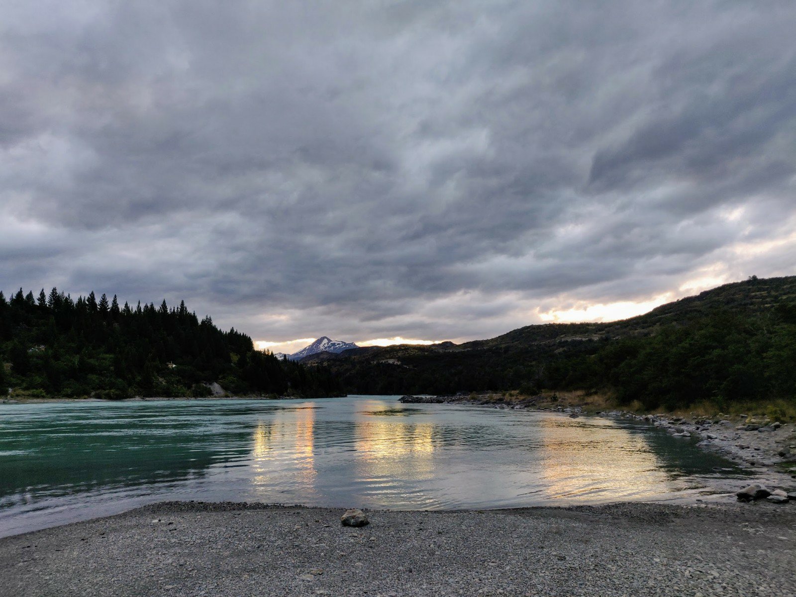
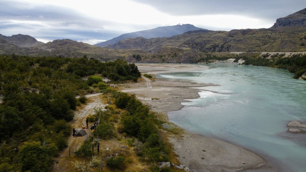
500m down the track, another little turning led to the edge of the braided river gravels and a raised turning space that was clearly the wild site, tucked well away and sheltered by bushes. Views across the immense river were magnificent, the only habitation a couple of cabanas on the opposite back, 400 m away. We patched Hannah’s knee up and then both went for a very bracing wash in the glacial river water, up to our hips and dowsing our arms and heads. We were 13km and a couple of hills from the national park entrance, and happy with the 48km on ripio we’d achieved today.
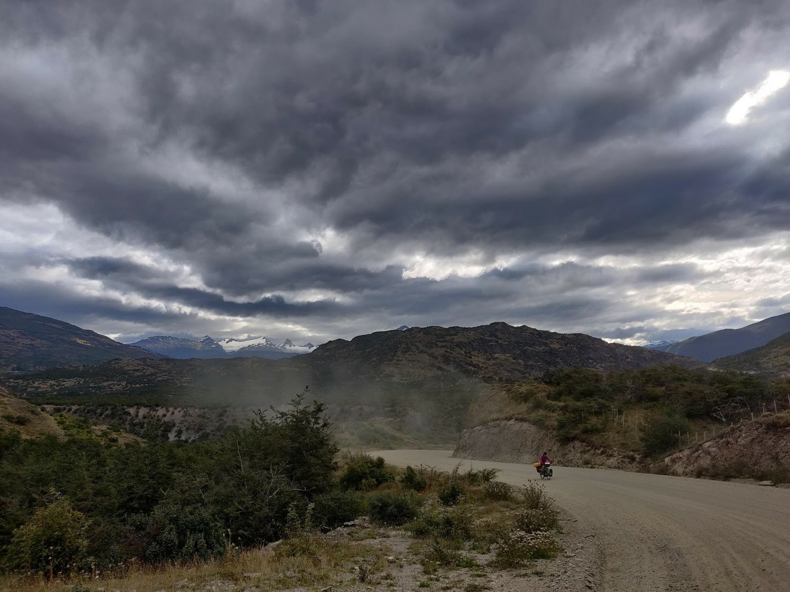
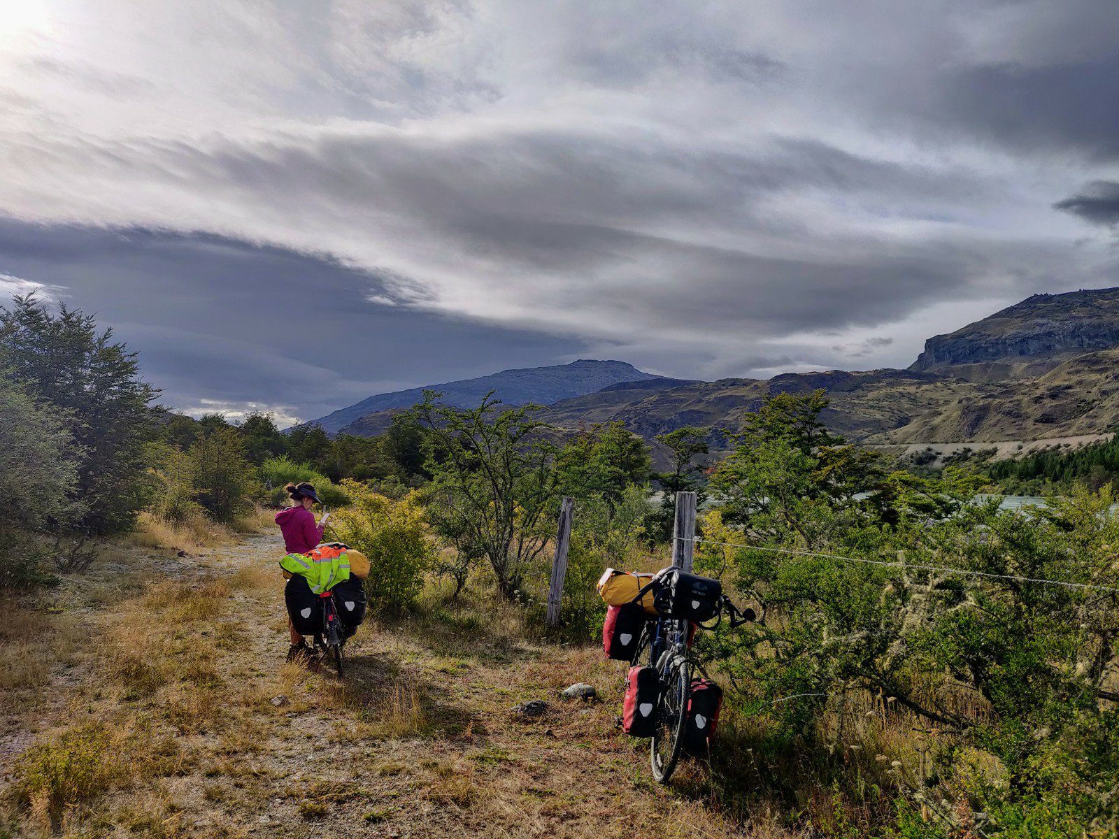
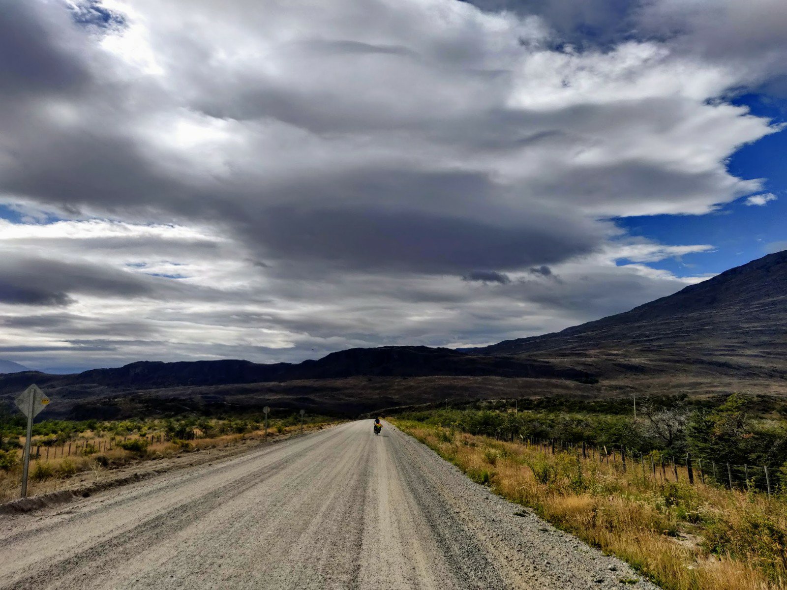
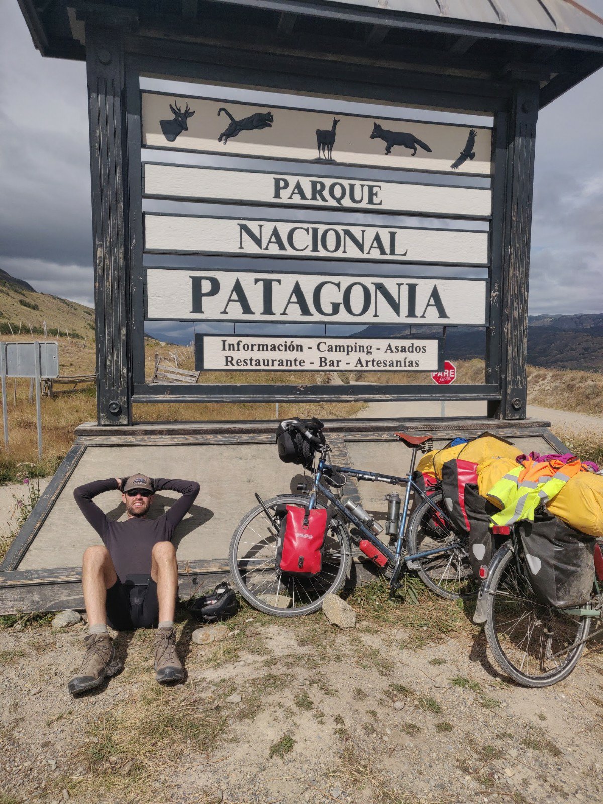
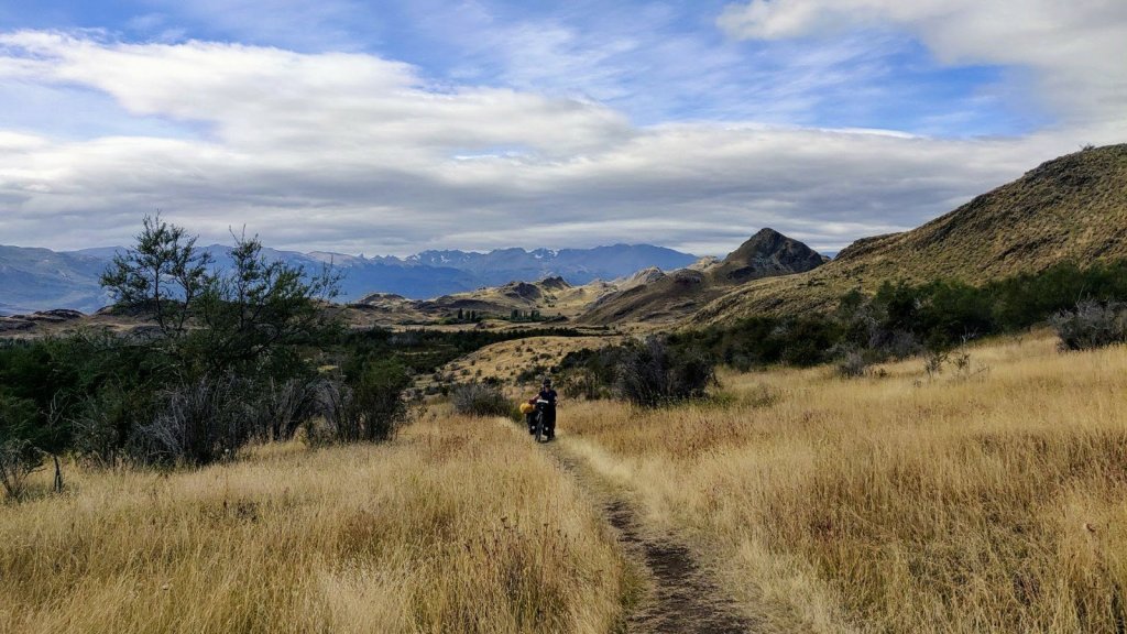
Tuesday morning dawned with the sun poking out from behind clouds, and just a few spots of rain in light winds. After breakfast Robbie tried a quick drone flight before we packed up and got underway. They was no sign of the pannier clip so we cable tied it onto the front rack for now and proceeded carefully up the loose gravel back to the Carretera. The route followed the river east steeply up and down and the 13km past slowly. Before the final hill we met another cyclist on a mountain bike also heading south, who must have had a lie in as he soon powered past us up the last big hill before the Patagonia national park entrance.
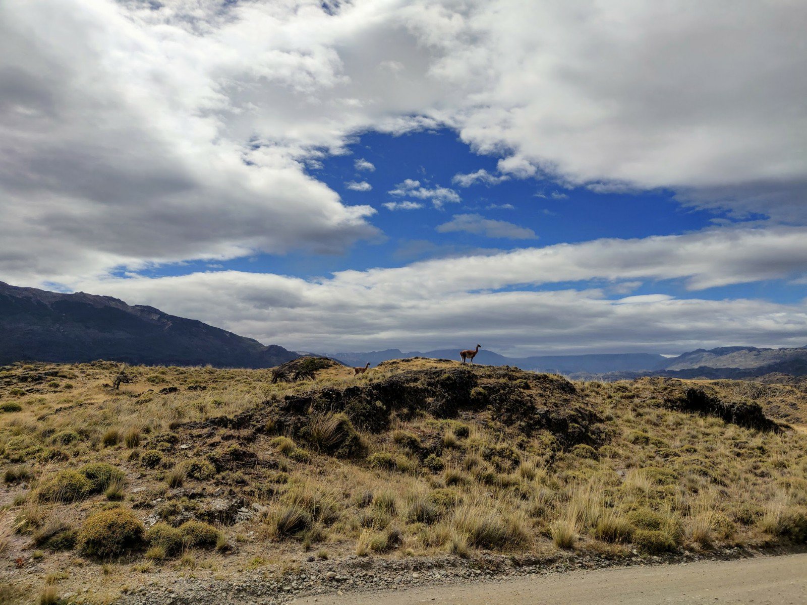
A brief rest at the entrance gate and we set off again uphill into the park. Almost immediately we spotted our first guanaco, grazing peacefully on a hilltop to the south some way away. Photos taken, we pushed on into the park, suddenly aware of the potential presence of pumas. The couple we met in Cerro Castillo had seen one cross the road in front of them here and we both cycled a little closer together under the gloomy skies.
Soon we emerged onto the wide open grass plains and were met with the glorious sight of clusters of guanaco in every direction. We found a hillock just off the road and sat down for lunch, watching the grazing animals around us. We were intrigued to see a few cows and horses as well, presumably left over from the park’s recent previous livestock inhabitants.

After lunch it was another 5 km to the park headquarters, during which we passed more guanaco and assorted birds. The headquarters comprised a collection of large dark buildings with steeply pitched rooves, scattered across a wide flat valley surrounded by hills. A helicopter and propellor plane were parked up at one end, whilst the biggest herd of guanacos we’d yet seen grazed freely across the valley, oblivious to any people wandering around. This felt even more like Jurassic Park than Queulat had done, and as we went up to the park office building it would have been no surprise to see some stegosaurus wandering past.
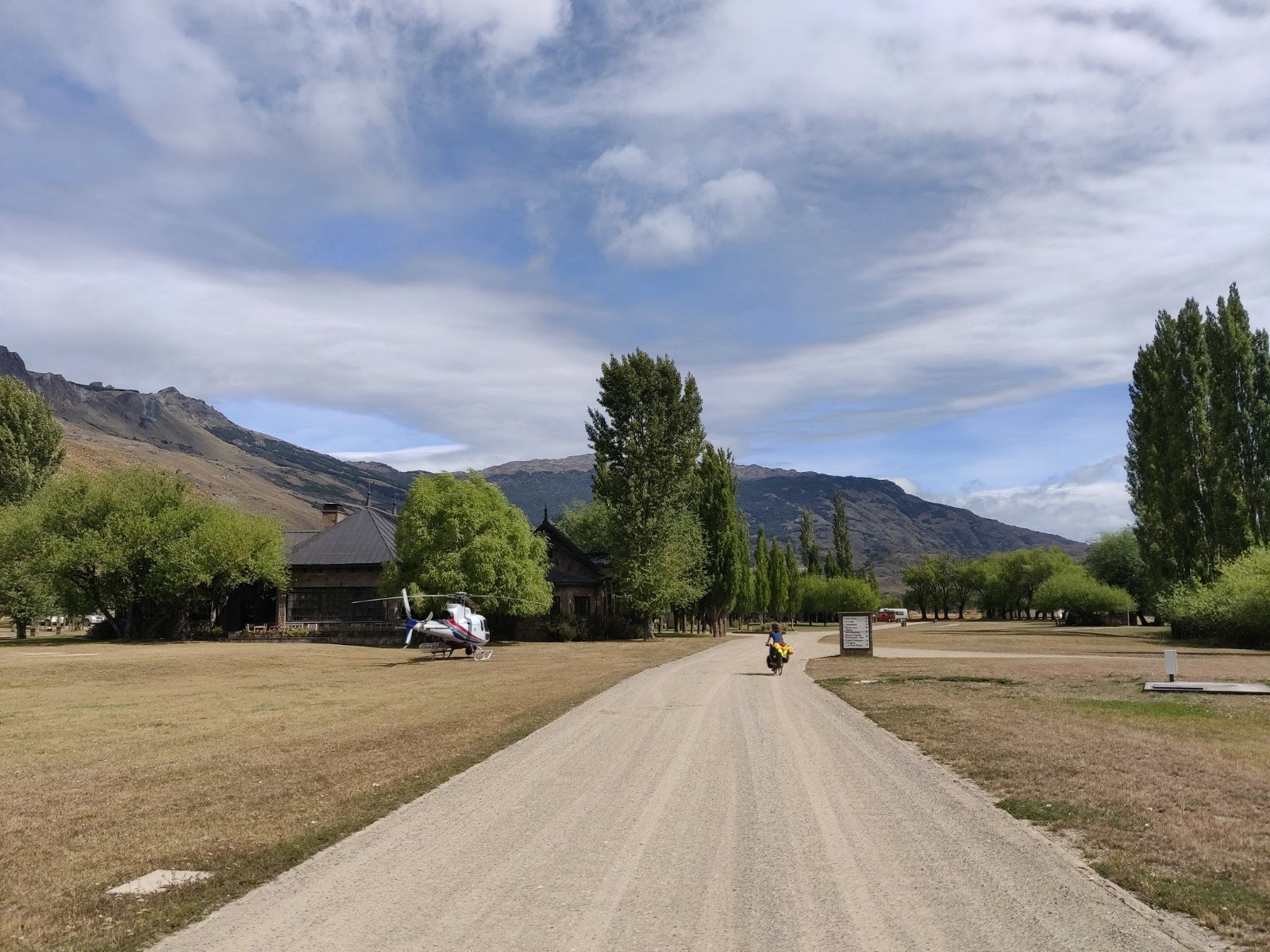
We bought our park entry tickets and paid for one nights camping before investigating the restaurant nearby. Here we learnt that the helicopter was part of a film crew making a documentary all about the Tompkins land regeneration work, of which the park was a key feature. Unfortunately for us, the film crew had booked out the restaurant entirely for tonight and tomorrow and there was nowhere else at all to buy any food. Staying two nights would be pushing our rations to the limit, so we decided to see how we felt tomorrow.
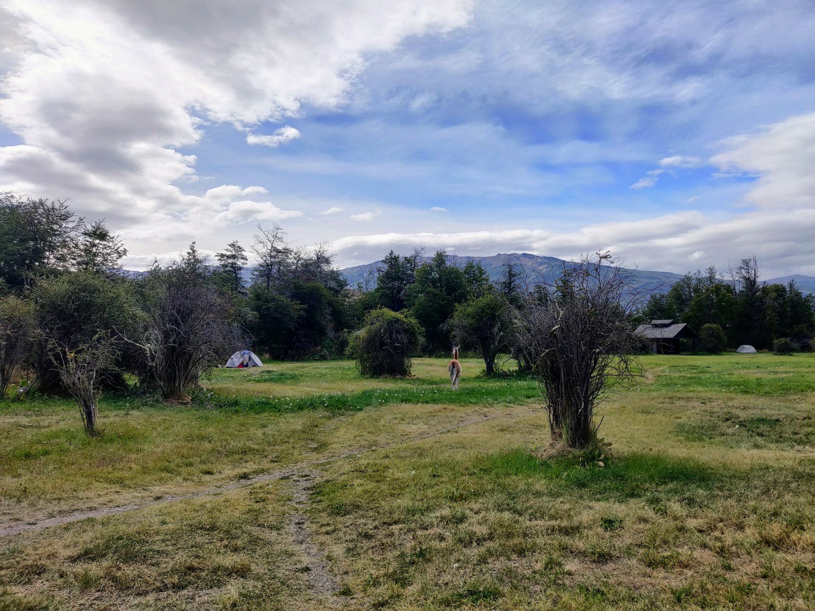
We cycled and walked our bikes the final 2 km to the enormous west winds campsite and pitched up at our own sheltered table spot. After a tepid but very welcome solar shower we relaxed in the late afternoon sun before cooking up some quinoa.

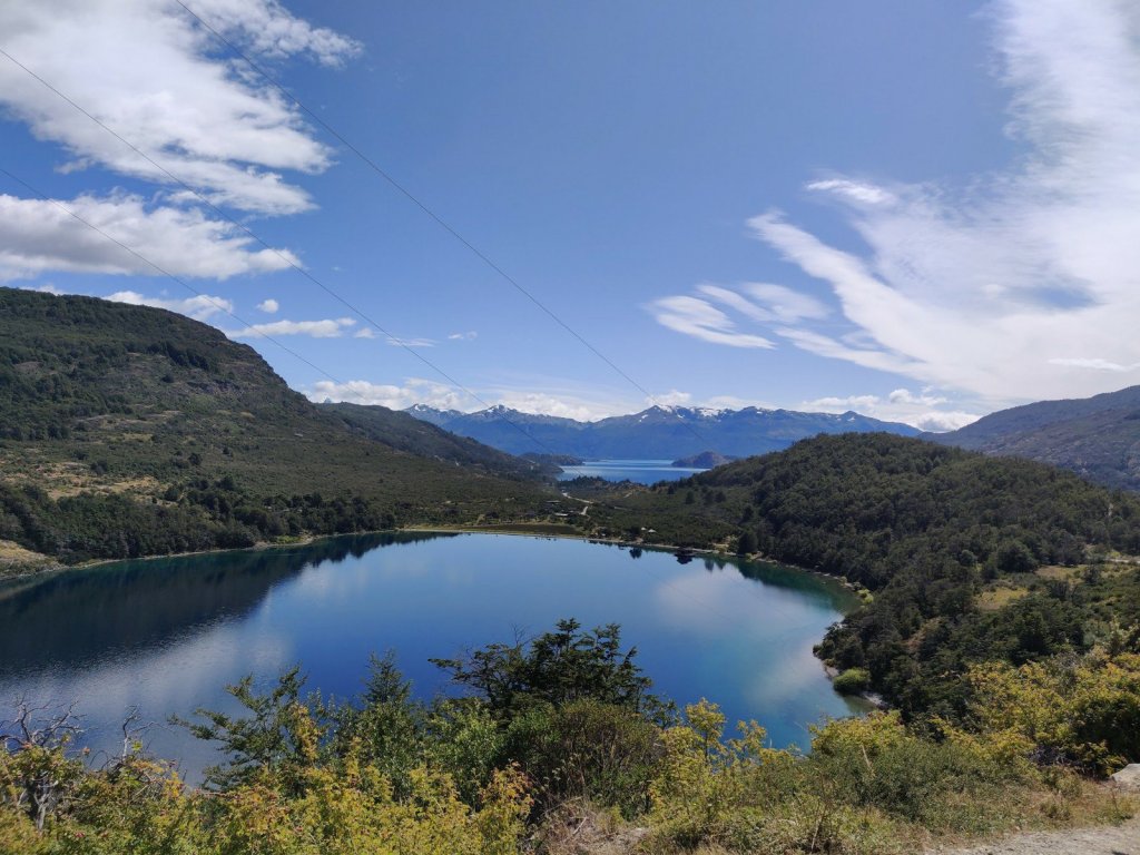
Seemingly endless succession of beautiful lakes. The drone shot shows just how lost the tent is in the big landscape. The only sign of humankind. Apparently insignificant there.
LikeLike